Hurricane Sandy, the 18th named tropical storm of the 2012 Atlantic Hurricane Season, is currently moving slowly up the Mid-Atlantic coast and with recent model tracks, landfall looks to be in central or southern New Jersey. The hurricane is a category one hurricane with max sustained winds at 75 mph, with gusts at 90 mph. The pressure is 952 mb and there is still 36 hours to landfall.
Hurricane Sandy has caused 41 deaths in the Caribbean. Strong winds and heavy downpours are currently over the Carolinas, and the force winds of the storm extend up to 700 miles from the center, while hurricane force wind extend up to 105 miles. Models have the storm turning towards the northwest early Tuesday. There is a high pressure system to the east and the clockwise flow of the high pressure will send Hurricane Sandy back west. Forecasters are calling the events set to occur near Halloween "Frankenstorm." As Sandy moves northwest, there is a stationary front approaching from the west, which will stall the storm and moisture associated with the front will combine with that of Sandy. When this happens Sandy will become an extratropical storm. This is because the core of Sandy with change from warm to cold, due to the merging with an Arctic Jet System.
Forecasters are calling for high storm surges along the Mid-Atlantic as well as heavy rainfall and strong winds. South Jersey, DC, Maryland and NYC are expected to receive around 5 to10" of rain. 8 states along the Mid-Atlantic have issued a state of emergency and Major Micheal Bloomberg has issued coastal evacuations in NYC as well as Governor Chris Christie in New Jersey. Over 12" of snow is also expected to fall in the higher elevations of Southwest Virginia and West Virgina.
Many residents are stocking up on food supplies, ahead of the storm. We are ready for the storm in my apartment! The electric companies are getting ready for downed trees and some areas may be out of power for a week.
Here is the current track of Hurricane Sandy:


Sandy's Wind Field

Hurricane Sandy has caused 41 deaths in the Caribbean. Strong winds and heavy downpours are currently over the Carolinas, and the force winds of the storm extend up to 700 miles from the center, while hurricane force wind extend up to 105 miles. Models have the storm turning towards the northwest early Tuesday. There is a high pressure system to the east and the clockwise flow of the high pressure will send Hurricane Sandy back west. Forecasters are calling the events set to occur near Halloween "Frankenstorm." As Sandy moves northwest, there is a stationary front approaching from the west, which will stall the storm and moisture associated with the front will combine with that of Sandy. When this happens Sandy will become an extratropical storm. This is because the core of Sandy with change from warm to cold, due to the merging with an Arctic Jet System.
Forecasters are calling for high storm surges along the Mid-Atlantic as well as heavy rainfall and strong winds. South Jersey, DC, Maryland and NYC are expected to receive around 5 to10" of rain. 8 states along the Mid-Atlantic have issued a state of emergency and Major Micheal Bloomberg has issued coastal evacuations in NYC as well as Governor Chris Christie in New Jersey. Over 12" of snow is also expected to fall in the higher elevations of Southwest Virginia and West Virgina.
Many residents are stocking up on food supplies, ahead of the storm. We are ready for the storm in my apartment! The electric companies are getting ready for downed trees and some areas may be out of power for a week.
Here is the current track of Hurricane Sandy:

Here is the visible satellite image:

The water vapor:

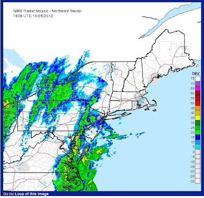
Radar:

Active Alerts:


Sandy's Wind Field
